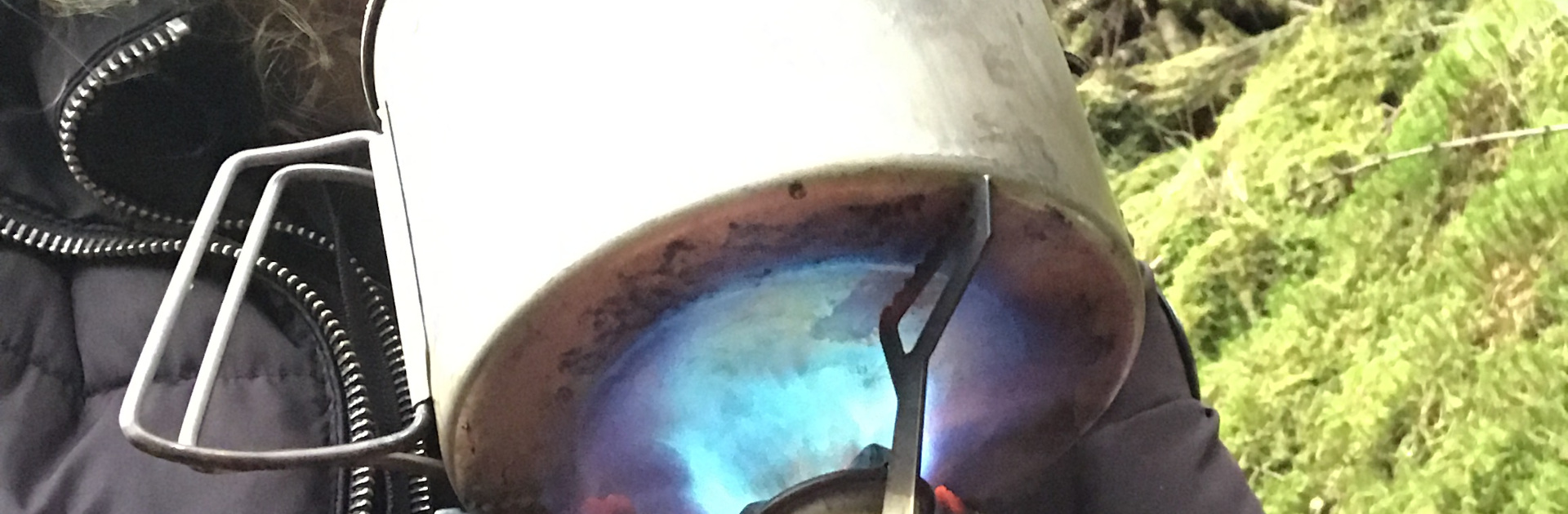
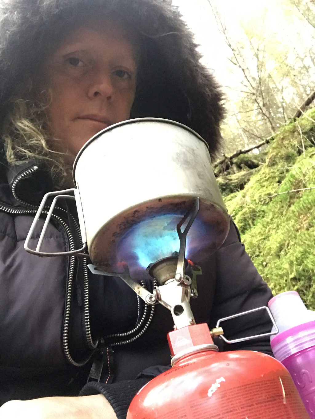
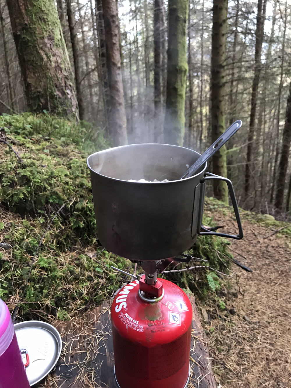
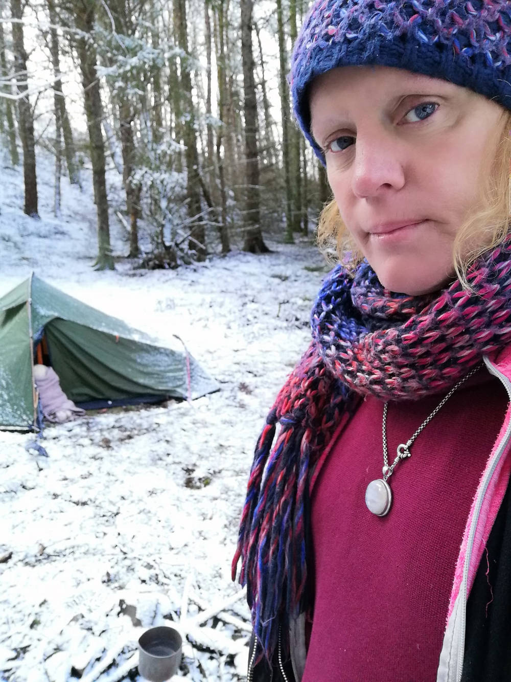
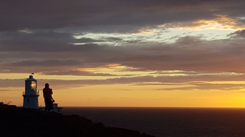
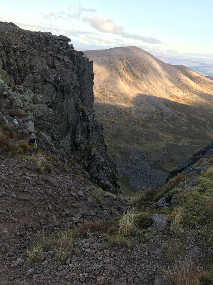
Brewing a pot of tea before my ascent to the summit of Ben Nevis.
Feral Living
With persecutions of our people becoming so virulent and widespread, there may come a time when you will be moved on endlessly. It's imperative that you know how to look after yourself, because the methodology is to traumatize you incrementally into catatonic states of disociation, inflicting suffering via voiding you from being able to look after yourself. Learn to live next to nature, and nature will heal as your ancestors arrive to console and walk with you.
- Introduction
- Conclusion
Introduction
There are many reasons why people live feral, but for the majority, living feral means being chased down into displacement. Harassment can be religious, financial, marital, work, etc. Whilst benefit is attained from seclusion, within reverence of prevail elements of nature, I don't believe that balancing precariously on the edge of civilization for years on end is a choice anybody would consensually make without being displaced by the disposition of entrenched circumstance.
“People dwell in the wilderness for two - three days, maximum a week or two, those who live feral for years have or are encountering some serious societal problems; they are usually white and male. Be humane towards them, they have probably been put through more dispairity than you'll know.”
Below is knowledge gained from my experience of living feral, I've not included everything I know, but I have included that which would have saved me a lot of trouble to have known. Living outside is about preserving common sense, about wrapping yourself up warm, so you don't make mistakes from poor judgements, arising from being cold, tired and more than often hungry. Danger arises from so many situations, and places; hindsight gain from other people's stories prevents needless suffering.
Well-being
Well-being is physical, mental and spiritual. Recite self-preservation to advert becoming susceptible to false charity (vinegar sponge tactics), be mindful of the opened fist of egalitarian socialism that'll attempt to slap you inconsolable from trust.
“Are you poor and needy… have you lived too well… want some open fist socialism… false charity slap you inconsolable from trust… whilst interloping… disinheriting and collectivising to interlope you're every sanctity?”.
Keep away from soup kitchens, day centres, handouts etc, you don't want to be receiving their offers of humble pie unless facing a life and death situation. Living with odour is nothing to suffering filth they spitefully yearn to subject you to.
- Read about hyperthermia, beware, consuming alcohol messes with your body's response to generate essential and appropriate heat, you might seem warmer, but you will be colder. The body's ability to generate heat again can take days or weeks of sobriety to become right.
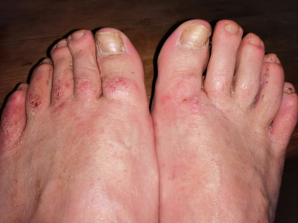
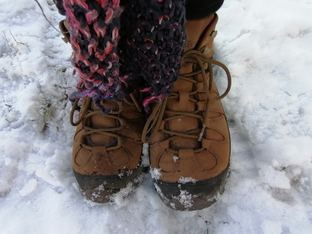
- Keep your feet dry! I cannot stress this enough, without your feet, you're going nowhere fast. River, stream and puddle water will not rot your feet as fast as dew from wet grass.
- Do not accept offerings of clothing or blankets without first boil washing these items; as acquiring head and body lice, impetigo, athlete's foot and scabies will drive you insane.
- Don't bother with water purifying tablets, if you don't have a clean, fresh source of water, what the hell are you doing in an area that is detrimental to your state of health.
- If you're living outside it's OK to smell a bit, also it is much better to additionally wash than to use toxic deodorants. Use fluoride free toothpaste, lemon grass oil for non-toxic insect repellent.
- Learn to talk bluntly, and be ready to project yourself as unfriendly. Apply appropriate demeanour to the given circumstance and always refuse requests to handshake strangers, especially in public.
- During midge season, avoid camping in the glen, near lochs or stagnant creeks. Pitch your tent on top of hills, anywhere elevated where there is wind, keep wrists and eyes covered when followed and swarmed.
- Avoid dwelling about roadside lay-bys, isolated car parks / toilets, you may walk into dogging or be subjected to sexual advances, at worst raped or murdered. Do not accept help or hitch-hike from such locations.
- Don't play along to provercation from tom foolery, they'll have you dancing to their evil tunes from cold lunacy all the way into scorced contempt. If degenerate locals subject you to fakery, you'll be worth more to them as nothing, so make something from yourself, when they despise your inherent worth with defacing acts of aborrent spite.
- Heated food served piping hot is important to your inherent sense of morale, when in a safe place allocate time to be kind to yourself. You body has probably carried you through hell, nuture as nature nurtured to renew and reinvigorate life, recognise sustinance.
- All mental illness comes from our people being alienated from one another. On the fringes of oblivion you'll see that soul is our people, who nuture and rebirth us into this world. Insanity means detachment, damnation is souless, ostracised indifferent from sanctity of your people.
- Hearts of darkness encroach as cuckoos, interloping our sanctities from false claims of deprivation derrived from cultured disparities. Observe these deviant shadows squirm as you rekindle your might, push them back into the darkness from whence they came.
Bad health will force you indoors and at worst will incur other / additional problems. It is really important you look after yourself, independence is paramount. Whilst being ill will get you sympathy, it will attract all the wrong people and could land you into a destructive hand to mouth relationship. It is really important to you keep up appearance, and eneavour to meet and interact with people "on the level".
Inventory
I spent years acquiring good equipment from bad, so skip disappointment and read some advice, this could save you a lot of bother when personalizing this check list to meet your requirements. Common sense is required when purchasing items from the list below, for example, you don't want a day / night glow fluorescent tent if you are wild camping. I'd rather have a white tent in a snowy, icy region and display an orange silk flag should I want to be found.
Try not to cut corners by going to cheap camping shops such as Trespass and Mountain Warehouse. This "outdoor" clothing appears the same, but more than often has poor heat retention and will soak up huge amounts of water rather than repel. I recommend local specialist mountain / camping shops that are not chain stores rather than Cotswold, Go Outdoors, Blacks and Millets. If, like me, you are walking over 60,000 steps a day you'll need hard wearing kit that will not fail when you most need it to work for you.
- Tent - Small, low profile tent, green or brown (difficult to see in day or night). Water / UV proof your tent (with silicone spray i.e. Nikwax etc) and always aim to dry before packing.
- Tent Pegs - Pegs that come with tents are never strong enough. Purchase tent stakes that are at least seven inches, V’ Tent Pegs are ideal, made from heavy-duty aluminium.
- Backpack - with a rain cover! Try not to strap equipment to the outside, weight balancing is essential for posture, to save you from accident such as a sprained ankle.
- Sleeping Bag - Everybody must have their own sleeping bag (when you're tired, you want undisturbed sleep). 4 seasons is essential, during warmer times you can unzip it.
- Sleeping Mat - Self inflatable base to keep out the ground cold, this item will increase warmth and comfort!
- Pillows - Can be soothing for a weary mind / head, but not essential, use your bag of clothes etc and save space by sometimes using hardness of backpack for a light sleep.
- Stove and fuel - Gas, mixture of butane and propane, pocket rocket burners are great, you want to cook quick, without lingering aroma, not endlessly fuck about with twigs.
- Cooking Pot and utensils - Strong Titanium pot will never rust and save fuel, (time / energy to heat pan before contents warmed!) lock or slide (not fold) together utensils.
- Water Bottles - Metal, these can double up as hot water bottles during a cold night, provide relief from periods and are generally more durable but risk being dented.
- Knife - Check what the laws are in the country you are in. I use a foldable lock knife, survival knifes are great, but do you really require one? Are you hunting?
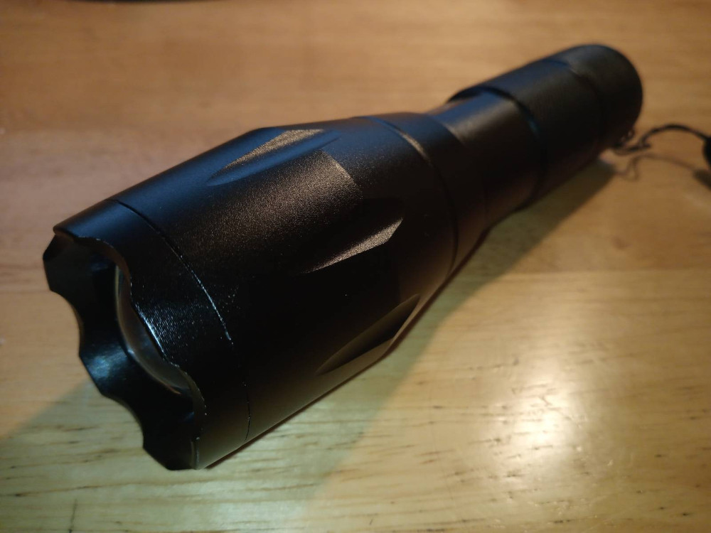
- Torch - Think of your circumstance, do you require 2000 lumen if there are predators around? Pen and full size LED torch is ideal (with SOS switch).
- Plastic bags - Keep items inside extra waterproofing, such as carrier bags, thicker the better, also use plastic Tupperware where it would be beneficial.
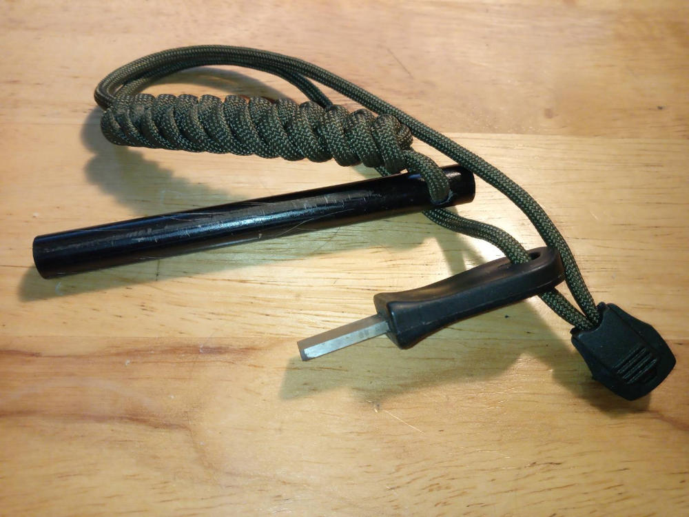
- Clipper lighters, magnifying glass and flint strike - if you are using matches make sure they are waxed. Keep spare lighter flints with you. Paraffin lighters are a big no no.
- Multimedia Phone - Purchase cheap phone with additional batteries to use as GPS mapping device. Download mapping application. Garmin devices are expensive!
- Burner Phone - Small phones last a week without charging, cheap to buy, and are durable and strong. Ideal to use when you only need to talk and text, and are easily replaceable.
- Bluetooth speaker / headphones - I used a small sound cube (1 1/2 inches!), as wireless ear buds are best for outdoors, as any loose wires will get caught up often.
- Powerbank - go for a flat and long, fast charging powerbank x2 storing at least, 26800Mah, must be strong and be capable of charging multiple devices at once.
- Candle / incense cones - For when you are tired of soulless LED glare, when you need to a rest on your inner sanctities, misery from loneliness can kill the weary.
- Walking sticks - It is OK to have something to lean on when your ankles are tired from bolder dashing. Useful for detecting peat bogs, defending against snakes etc.
- Clothing - Thin cotton layers, quick drying and water retardant fleece, hooded double zipped jacket and maybe a metal ringlet poncho (emergency lean-tos). No denim, or synthetic material other than for external shielding, i.e.: a raincoat etc. Woollen scarfs (long, loose weave) and gloves. Sunglasses protect eyes from glare / wind.
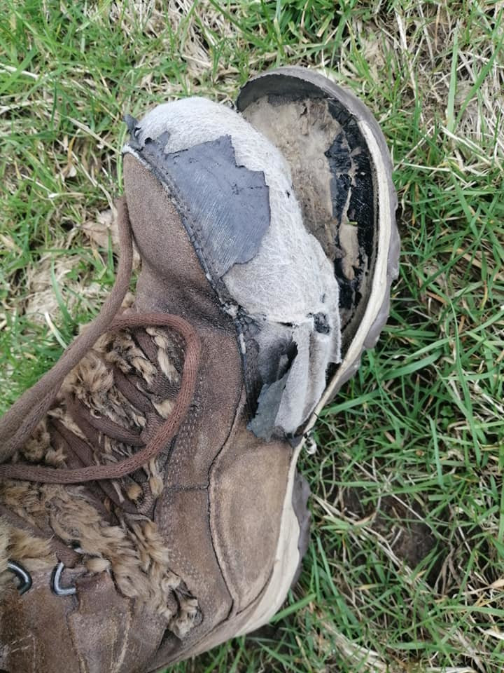
- Boots - Walking boots, roomy made from gortex is ideal. Never dry boots by strong heat, glue holding the sole will dissolve and you'll be flip-flopping, decimated as Jim Crow.
- Health - Sunblock SPF 50, thick moisturizer, antihistamines, antifungal talc, antiseptic cream, vegetable based soap, support bandage, multi-vitamins, pain relief and tweezers.
- Repair - Sewing needles, cotton and nylon threads, a small pair of scissors (blunt ended), patch material, waterproof boot polish and durable cloth.
- Mascot - Many famous explorers carried mascots, a small teddy, stuffed toy, rag doll, could be anything consolidating, a key ring, lock of hair or maybe a photograph of your family.
Today, within most camping and hiking shops, there is something for every eventuality. There is so much camping equipment that is really unnecessary, an easy life is not what the great outdoors is about and if you think this way, sooner or later the elements will get the better of you. To be tough and hardy when embracing fortitude, I roamed the United Kingdom for years with only a blanket! Keep your equipment safe, do not turn your back on your bag unless you are sure you are alone; your life will be harder if you loose or if your equipment stolen.
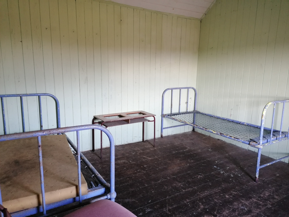
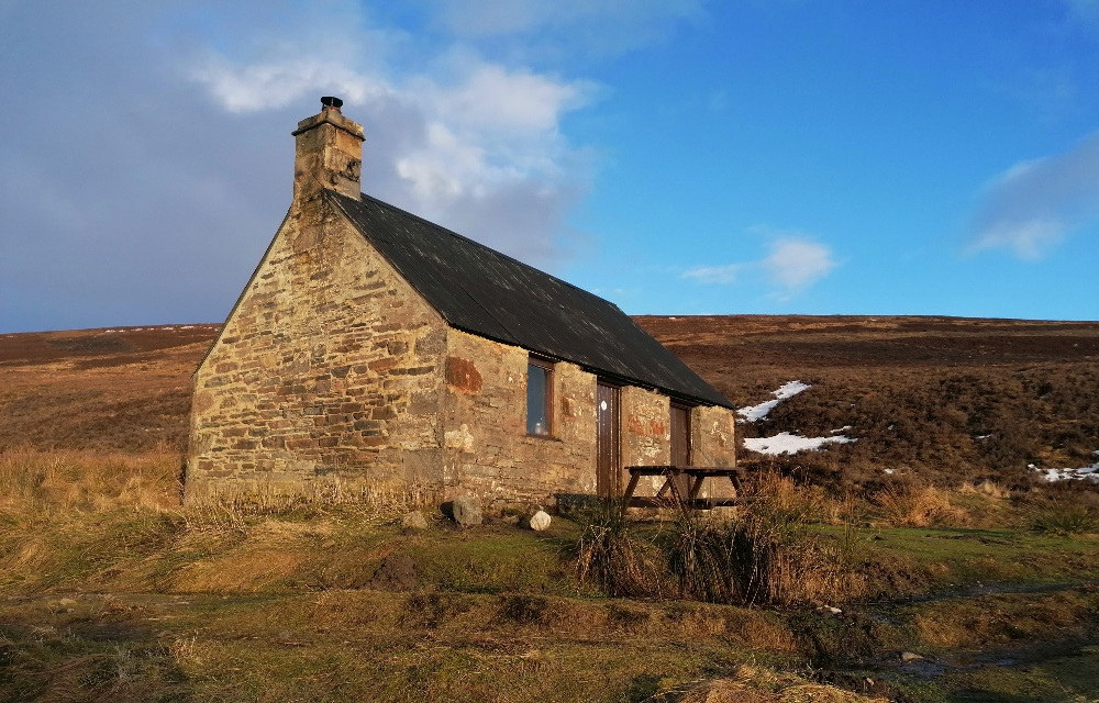
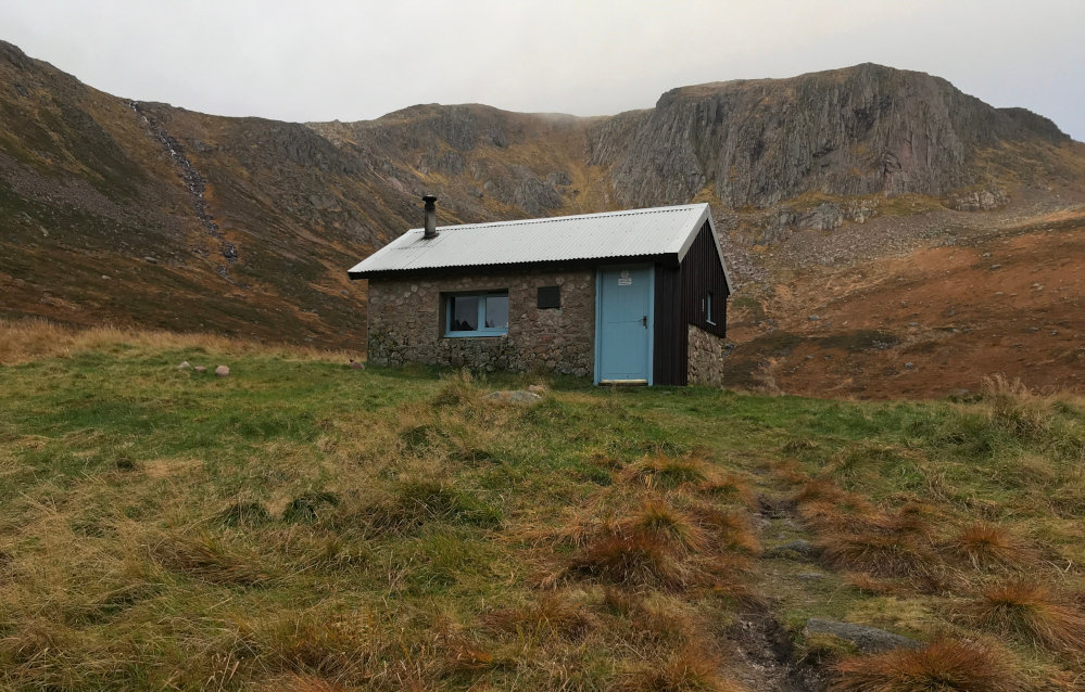
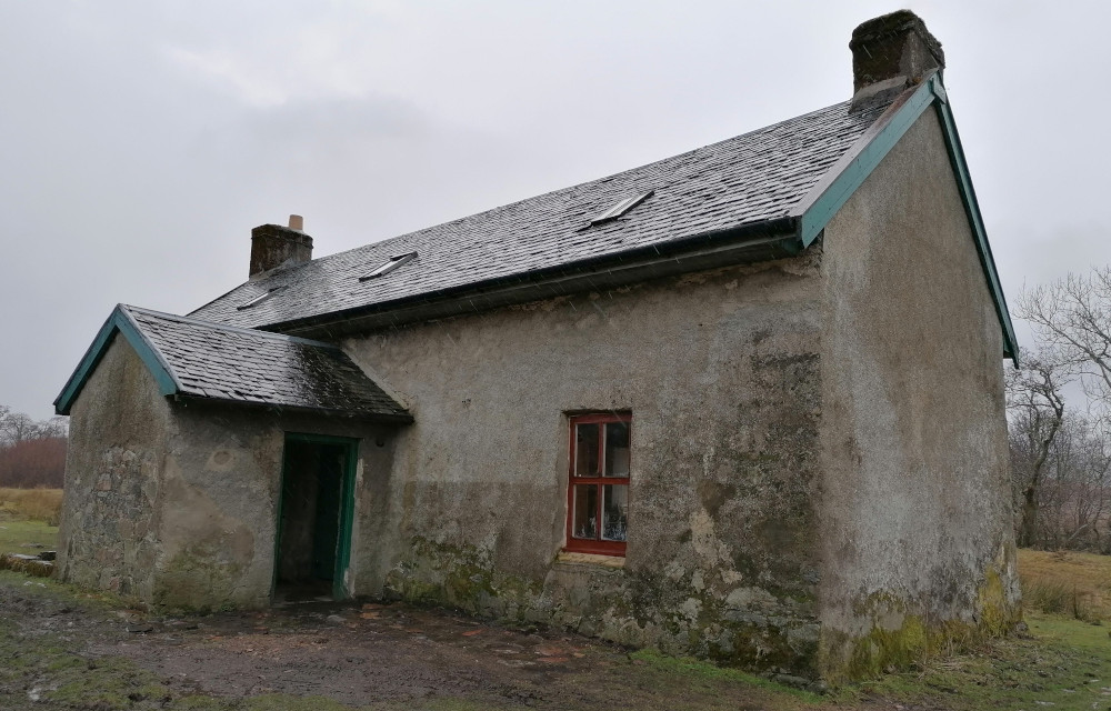
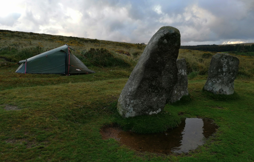
Bothies
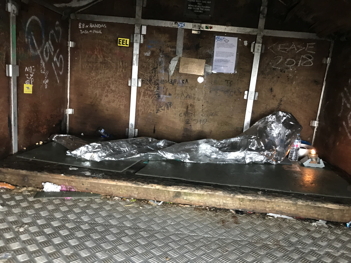
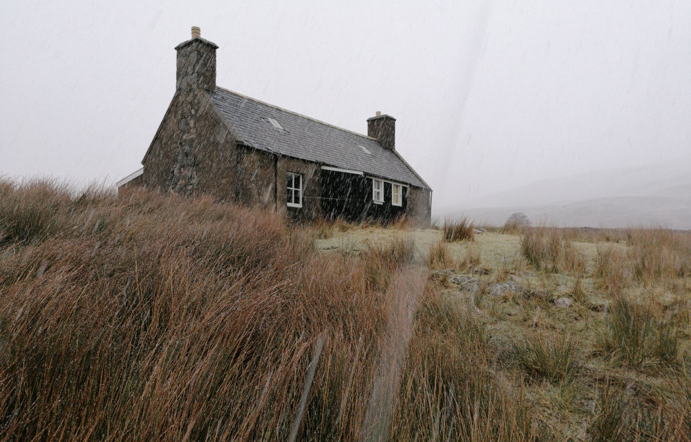
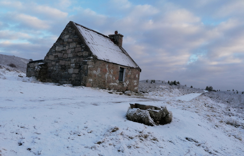
A bothy is a basic shelter, usually left unlocked and available for anyone to use free of charge. Bothies are found in remote mountainous areas of Scotland, Northern England, Ulster and Wales. They are particularly common in the Scottish Highlands, but related buildings can be found around the world (for example, in the Nordic countries there are wilderness huts).
Some local folks in the Highlands view bothies as houses of sin, bothies on the Isle of Lewis and other places have previously been torn down, dismantled brick by brick for being used as illegal drinking dens. Sometimes, it is best not to make it known to locals that you are using them.
Bothies have a common sense approach to conduct:
- Bothies are used entirely at users' own risk.
- Leave the bothy clean and tidy with dry kindling for the next visitors. Make other visitors welcome.
- Report any damage to whoever maintains the bothy. Take out all rubbish which you can't burn. Avoid burying rubbish; this pollutes the environment. Please do not leave perishable food as this attracts vermin. Guard against fire risk and ensure the fire is out before you leave. Make sure the doors and windows are properly closed when you leave.
- If there is no toilet at the bothy, please bury human waste out of sight and well away from the water supply; never use the vicinity of the bothy as a toilet.
- Never cut live wood or damage estate property. Use fuel sparingly.
- Large groups and long stays are to be discouraged – bothies are intended for small groups on the move in the mountains.
- Respect any restrictions on use of the bothy, for example during stag stalking or at lambing time. Please remember, bothies are available for short stays only. The owner's permission must be obtained if you intend an extended stay.
- Because of overcrowding and lack of facilities, large groups (6 or more) should not use a bothy nor camp near a bothy without first seeking permission from the owner. Bothies are not available for commercial groups
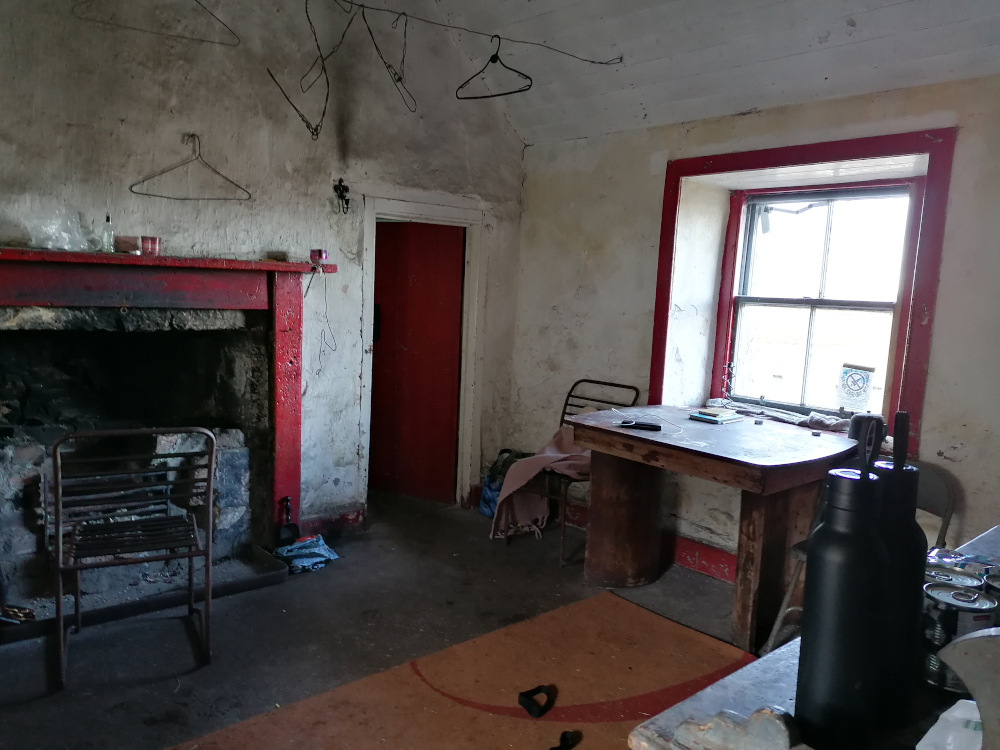
Most bothies are ruined buildings which have been restored to a basic standard, providing a windproof and watertight shelter. They vary in size from little more than a large box up to two-storey cottages. They usually have designated sleeping areas, which commonly are either an upstairs room or a raised platform, thus allowing one to keep clear of cold air and draughts at floor height. Most have a fireplace and are near a natural source of water. A spade may be provided to bury waste. Because they are freely available to all, the continued existence of bothies relies on users helping look after them.
Here is a list of bothies and where to find them, I don't believe the list to be complete. I heard there are one or two secret bothies from unsubstantiated rumour that are not disclosed to the public. The grid reference numbers (Lat/ Long) are linked to Open Street Map, this website is not responsible for, nor can edit content served from the Open Street Map website. There are many mobile phone navigation apps, a popular app is View Ranger, now called Outdoor active, but there are others where for a subscription you can access and download more detailed Ordinance Survey maps.
| Name | District / Region | Grid ref Lat/ Long | Accommodates | Elevation | Photograph |
|---|---|---|---|---|---|
| Ben Alder Cottage | Rannoch, Central Highlands | NN499680 56.779°N 4.459°W |
4 | 373 m (1,224 ft) Ben Alder | |
| Blackburn of Corrieyairack | Monadhliath, Central Highlands | NH382029 57.088°N 4.672°W |
0+ 8 floor | 344 m (1,129 ft) Culachy | |
| Glenbuck | Monadhliath, Central Highlands | NN336996 57.057°N 4.746°W |
Several | 283 m (928 ft) Aberchalder | |
| Lairig Leacach | Lochaber, Central Highlands | NN282738 56.823°N 4.816°W |
8 | 467 m (1,532 ft) Killiechonate and Mamores | |
| Loch Chiarain | Lochaber, Central Highlands | NN289634 56.731°N 4.798°W |
1+ large attic | 370 m (1,214 ft) Killiechonate and Mamores | |
| Luib Chonnal | Monadhliath, Central Highlands | NN394936 57.006°N 4.646°W |
0+ attic | 331 m (1,086 ft) Braeroy | |
| Meanach | Lochaber, Central Highlands | NN266685 56.775°N 4.839°W |
3 | 345 m (1,132 ft) Killiechonate and Mamores | |
| Staoineag | Lochaber, Central Highlands | NN296678 56.771°N 4.791°W |
Several | 293 m (961 ft) Killiechonate and Mamores | |
| Name | District / Region | Grid ref Lat/ Long | Accommodates | Elevation | Photograph |
|---|---|---|---|---|---|
| Allt Scheicheachan | Badenoch, Eastern Highlands | NN835737 56.840°N 3.912°W |
2+ attic | 487 m (1,598 ft) Atholl | 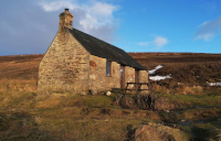 |
| Callater Stable | Mounth, Eastern Highlands | NO178845 56.944°N 3.353°W |
8 | 514 m (1,686 ft) Invercauld | |
| Charr | Mounth, Eastern Highlands | NO616831 56.938°N 2.633°W |
3 | 264 m (866 ft) Glendye | |
| Corrour | Cairngorms, Eastern Highlands | NN981958 57.042°N 3.681°W |
4 | 564 m (1,850 ft) Mar Lodge (NTS) | |
| Faindouran | Cairngorms, Eastern Highlands | NJ082062 57.137°N 3.519°W |
2+ attic | 603 m (1,978 ft) Inchrory | |
| Fords of Avon Refuge Hut | Cairngorms, Eastern Highlands | NJ042032 57.110°N 3.584°W |
0 | 689 m (2,260 ft) Abernethy (RSPB} | 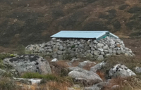 |
| Garbh Choire Refuge hut | Cairngorms, Eastern Highlands | NN959986 57.067°N 3.718°W |
0 | 710 m (2,329 ft) Mar Lodge (NTS) | |
| Gelder Shiel Stable | Mounth, Eastern Highlands | NO258900 56.995°N 3.224°W |
6 | 444 m (1,457 ft) Balmoral | |
| Glas Allt Shiel Bothy | Loch Muick, Eastern Highlands | NO276824 56.927°N 3.191°W |
6 in attic | 400 m (1,312 ft) Balmoral Estate | |
| Hutchison Memorial Hut | Cairngorms, Eastern Highlands | NO023998 57.078°N 3.613°W |
2+ 4 floor | 747 m (2,451 ft) Mar Lodge (NTS) | 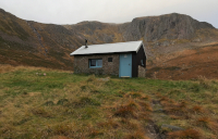 |
| Ruigh Aiteachain | Cairngorms, Eastern Highlands | NN847928 57.012°N 3.900°W |
10+ attic | 389 m (1,276 ft) Glenfeshie | |
| Ruighe Ealasaid | Cairngorms, Eastern Highlands | NO003869 56.962°N 3.643°W |
Unknown | 439 m (1,440 ft) Mar Lodge | |
| Ryvoan | Cairngorms, Eastern Highlands | NJ006115 57.184°N 3.646°W |
4 | 394 m (1,293 ft) Abernethy (RSPB) | 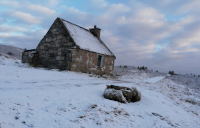 |
| Shielin of Mark | Mounth, Eastern Highlands | NO337827 56.930°N 3.092°W |
2 | 644 m (2,113 ft) Dalhousie | |
| Tarf Hotel (Feith Uaine) | Badenoch, Eastern Highlands | NN927789 56.889°N 3.763°W |
7 | 566 m (1,857 ft) Atholl | |
| Name | District / Region | Grid ref Lat/ Long | Accommodates | Elevation | Photograph |
|---|---|---|---|---|---|
| Bearnais | Wester Ross, North West Highlands | NH021431 57.434°N 5.298°W |
2 | 279 m (915 ft) Attadale | |
| Camasunary | Skye, North West Highlands | NG517183 57.190°N 6.112°W |
16 | 5 m (16 ft) Camasunary | |
| Camban | Kintail, North West Highlands | NH053184 57.214°N 5.225°W |
Several | 279 m (915 ft) West Affric (NTS) | |
| Coire Fionnaraich | Wester Ross, North West Highlands | NG950480 57.476°N 5.421°W |
Several | 180 m (591 ft) Fionnaraich | |
| Craig | Wester Ross, North West Highlands | NG774639 57.610°N 5.727°W |
Several | 83 m (272 ft) SYHA | |
| Easan Dorcha | Wester Ross, North West Highlands | NH012526 57.519°N 5.323°W |
0 | 215 m (705 ft) Coulin | |
| Lookout | Skye, North West Highlands | NG412763 57.701°N 6.344°W |
3+ 4 on the floor | 82 m (269 ft) MBA | |
| Maol Bhuidhe | Wester Ross, North West Highlands | NH053360 57.372°N 5.241°W |
many in attic | 261 m (856 ft) Killilan | |
| Ollisdal | Skye, North West Highlands | NG213394 57.360°N 6.636°W |
Limited | 89 m (292 ft) Glendale | |
| Taigh Thormoid Dhuibh | Skye, North West Highlands | NG612524 57.499°N 5.988°W |
6 | 15 m (49 ft) Raasay | |
| Uags | Applecross, North West Highlands | NG723351 57.349°N 5.787°W |
1 + attic | 23 m (75 ft) Applecross | |
| Uisinis | Outer Hebrides, North West Highlands | NF849332 57.280°N 7.231°W |
4 | 24 m (79 ft) South Uist | |
| Name | District / Region | Grid ref Lat/ Long | Accommodates | Elevation | Photograph |
|---|---|---|---|---|---|
| A' Chuil | Lochaber, Western Highlands | NM944924 56.977°N 5.384°W |
7 | 137 m (449 ft) Glendessary | |
| Dibidil | Rùm, Western Highlands | NM393928 56.952°N 6.289°W |
6 | 29 m (95 ft) Scottish Natural Heritage | |
| Gleann Dubh-lighe | Lochaber, Western Highlands | NM945820 56.884°N 5.375°W |
2+ | 128 m (420 ft) Fassfern | |
| Glenpean | Lochaber, Western Highlands | NM936904 56.958°N 5.396°W |
2+ large attic | 106 m (348 ft) Glendessary | |
| Guirdil | Rùm, Western Highlands | NG320014 57.025°N 6.418°W |
4+ | 21 m (69 ft) Scottish Natural Heritage | |
| Invermallie | Lochaber, Western Highlands | NN136888 56.953°N 5.067°W |
4+ large attic | 45 m (148 ft) Locheil | 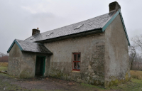 |
| Kinbreack | Lochaber, Western Highlands | NN002961 57.013°N 5.292°W |
0+ attic | 182 m (597 ft) Locheil | |
| Oban | Lochaber, Western Highlands | NM863901 56.952°N 5.515°W |
Many | 11 m (36 ft) Meoble | |
| Sourlies | Lochaber, Western Highlands | NM868951 56.997°N 5.513°W |
8 | 24 m (79 ft) Camusrory | |
| Suardalan | Lochaber, Western Highlands | NG883173 57.197°N 5.506°W |
9 | 113 m (371 ft) Glenelg Grazing | |
| Name | District / Region | Grid ref Lat/ Long | Accommodates | Elevation | Photograph |
|---|---|---|---|---|---|
| Abyssinia | Loch Lomond, Southwest Highlands | NN256117 56.266°N 4.818°W |
8 | 250 m (820 ft) Strone | |
| Cadderlie | North Argyll, Southwest Highlands | NN047370 56.486°N 5.175°W |
4 | 14 m (46 ft) Loch Etive | |
| Carron | Knapdale, Southwest Highlands | NR944996 56.145°N 5.311°W |
2+ floor | 188 m (617 ft) Ederline | |
| Cruib | Jura, Southwest Highlands | NR567829 55.977°N 5.902°W |
5 | 2 m (7 ft) Rantallaine | |
| Doune Byre | Loch Lomond, Southwest Highlands | NN332144 56.293°N 4.696°W |
4 | 71 m (233 ft) Glenfalloch | |
| Essan | Wester Ross, Southwest Highlands | NM817817 56.875°N 5.584°W |
12 | 34 m (112 ft) Inverailort | |
| Glengarrisdale | Jura, Southwest Highlands | NR644970 56.107°N 5.790°W |
4 | 7 m (23 ft) Ardlussa | |
| Leacraithnaich | Ardgour, Southwest Highlands | NM742472 56.562°N 5.676°W |
4 | 148 m (486 ft) Ardtornish | |
| Mark Cottage | Loch Lomond, Southwest Highlands | NS229952 56.116°N 4.849°W |
6 | 9 m (30 ft) Forestry Commission | |
| Resourie | Ardgour, Southwest Highlands | NM861710 56.781°N 5.502°W |
10 | 139 m (456 ft) Glenhurich Forest | |
| Rowchoish | Loch Lomond, Southwest Highlands | NN336043 56.202°N 4.684°W |
12 | 41 m (135 ft) East Lomond Forest | |
| Glen Duror | Lochaber, Southwest Highlands | NN022539 56.635°N 5.227°W |
4 | 203 m (666 ft) Lorne Forest | |
| Tomsleibhe | Mull, Southwest Highlands | NM617372 56.466°N 5.869°W |
10 | 94 m (308 ft) Glen Forsa | |
| Name | District / Region | Grid ref Lat/ Long | Accommodates | Elevation | Photograph |
|---|---|---|---|---|---|
| Achnanclach | Sutherland, Northern Highlands | NC630511 58.427°N 4.346°W |
Several | 148 m (486 ft) Syre | 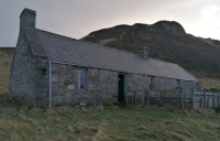 |
| Coiremor | Ross-shire, Northern Highlands | NH305888 57.857°N 4.858°W |
Several | 318 m (1,043 ft) Corriemulzie | |
| Croft House, Lochstrathy | Sutherland, Northern Highlands | NC793490 58.412°N 4.067°W |
Several | 160 m (525 ft) Strathy South | |
| Glencoul | Sutherland, Northern Highlands | NC270303 58.228°N 4.947°W |
4 | 11 m (36 ft) Reay Forest | |
| Glendhu | Sutherland, Northern Highlands | NC283337 58.259°N 4.928°W |
Upstairs | 25 m (82 ft) Reay Forest | |
| Kearvaig | Sutherland, Northern Highlands | NC292727 58.609°N 4.941°W |
2+ attic | 9 m (30 ft) Cape Wrath MOD | |
| Knockdamph | Sutherland, Northern Highlands | NH285953 57.915°N 4.895°W |
Several | 233 m (764 ft) East Rhidorroch | |
| Schoolhouse, Duag Bridge | Sutherland, Northern Highlands | NH340975 57.935°N 4.805°W |
5 | 99 m (325 ft) Corriemulzie | |
| Shenavall | Wester Ross, Northern Highlands | NH066810 57.777°N 5.254°W |
Several | 128 m (420 ft) Gruinard | |
| Strabeg | Sutherland, Northern Highlands | NC391518 58.425°N 4.756°W |
Several | 35 m (115 ft) Eriboll | 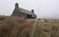 |
| Strathan | Sutherland, Northern Highlands | NC247612 58.503°N 5.010°W |
2+ | 62 m (203 ft) Keoldale | |
| Strathchailleach | Sutherland, Northern Highlands | NC249658 58.545°N 5.010°W |
2 | 95 m (312 ft) Keoldale | |
| Suileag | Sutherland, Northern Highlands | NC149212 58.140°N 5.145°W |
8 | 137 m (449 ft) Glencanisp | |
| Name | District / Region | Grid ref Lat/ Long | Accommodates | Elevation | Photograph | |
|---|---|---|---|---|---|---|
| Brattleburn | Lowther Hills, Southern Scotland | NT016069 55.346°N 3.554°W |
2+ Attic | 275 m (902 ft) | ||
| Burlywhag | Lowther Hills, Southern Scotland | NS971001 55.284°N 3.622°W |
2 | 360 m (1,181 ft) Queensberry | ||
| Clennoch | Galloway, Southern Scotland | NS603002 55.276°N 4.201°W |
6 | 416 m (1,365 ft) Moorbrock | ||
| Dryfehead | Dumfriesshire, Southern Scotland | NY170999 55.286°N 3.308°W |
6 | 310 m (1,017 ft) Tilhill Forestry | ||
| Gameshope | Dumfriesshire, Southern Scotland | NT135185 55.453°N 3.371°W |
8 | 419 m (1,375 ft) Borders Forest | ||
| Greensykes | Dumfriesshire, Southern Scotland | NT312000 55.290°N 3.084°W |
8 | 268 m (879 ft) Greensykes | 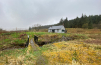 |
|
| Kettleton Byre | Lowther Hills, Southern Scotland | NS912021 55.301°N 3.716°W |
4 | 356 m (1,168 ft) Queensberry | ||
| Leysburnfoot | Liddesdale, Southern Scotland | NY536976 55.272°N 2.732°W |
250 m (820 ft) | |||
| Over Phawhope | Dumfriesshire, Southern Scotland | NT183082 55.361°N 3.293°W |
8 | 395 m (1,296 ft) | ||
| Tunskeen | Galloway, Southern Scotland | NX425906 55.184°N 4.476°W |
6 | 324 m (1,063 ft) Galloway Forest | ||
| White Laggan | Galloway, Southern Scotland | NX466775 55.068°N 4.403°W |
6 | 264 m (866 ft) Galloway Forest | ||
| Name | District / Region | Grid ref Lat/ Long | Accommodates | Elevation | Photograph |
|---|---|---|---|---|---|
| Cross Fell (Greg's Hut) | North Pennines, Northern England | NY690355 54.713°N 2.481°W |
6-10 | 690 m (2,264 ft) | |
| Dubs Hut | Lake District, Northern England | NY209134 54.510°N 3.223°W |
480 m (1,575 ft) | ||
| Flittingford | Kielder, Northern England | NY754886 55.192°N 2.387°W |
4 | 281 m (922 ft) Forest Enterprise England | |
| Great Lingy Hut | Lake District, Northern England | NY312337 54.694°N 3.068°W |
3-4 | 600 m (1,969 ft) Lake District National Park | |
| Green | Kielder, Northern England | NY740786 55.101°N 2.409°W |
272 m (892 ft) | ||
| Haughtongreen | Kielder, Northern England | NY788713 55.035°N 2.333°W |
248 m (814 ft) | ||
| Kershopehead | North Pennines, Borders | NY544863 55.169°N 2.717°W |
2 + 10 floor | 248 m (814 ft) | |
| Mosedale Cottage | Lake District, Northern England | NY495095 54.478°N 2.781°W |
12+ Floor | 450 m (1,476 ft) | |
| Roughside | Kielder, Northern England | NY745833 55.143°N 2.401°W |
220 m (722 ft) | ||
| Spithope | Cheviots, Northern England | NT769057 55.344°N 2.367°W |
340 m (1,115 ft) | 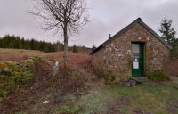 |
|
| Wainhope | Kielder, Northern England | NY671925 55.226°N 2.519°W |
270 m (886 ft) | ||
| Warnscale Head | Lake District, Northern England | NY206132 54.508°N 3.228°W |
0 | 460 m (1,509 ft) | |
| Name | District / Region | Grid ref Lat/ Long | Accommodates | Elevation | Photograph |
|---|---|---|---|---|---|
| Arenig Fawr | Snowdonia, Wales | SH851380 52.929°N 3.712°W |
3 | 400 m (1,312 ft) Welsh Water | |
| Cae Amos | Snowdonia, Wales | SH517454 52.986°N 4.211°W |
216 m (709 ft) | ||
| Dulyn | Snowdonia, Wales | SH705664 53.179°N 3.939°W |
0 + 10 floor | 510 m (1,673 ft) | |
| Grwyne Fawr | Black Mountains, Wales | SO225312 51.974°N 3.129°W |
4 | 552 m (1,811 ft) | |
| Lluest Cwm Bach | Cambrian Mountains, Wales | SN900705 52.321°N 3.614°W |
6-7 | 350 m (1,148 ft) Elan Valley Trust | |
| Moel Prysgau | Cambrian Mountains, Wales | SN806611 52.235°N 3.750°W |
378 m (1,240 ft) Natural Resources Wales | ||
| Nant Rhys | Cambrian Mountains, Wales | SN836792 52.399°N 3.711°W |
466 m (1,529 ft) | ||
| Nant Syddion | Cambrian Mountains, Wales | SN773791 52.396°N 3.804°W |
18+ | 310 m (1,017 ft) Forest Enterprise Ceredigion Area | |
| Penrhos Isaf | Snowdonia, Wales | SH737238 52.798°N 3.874°W |
169 m (554 ft) | ||
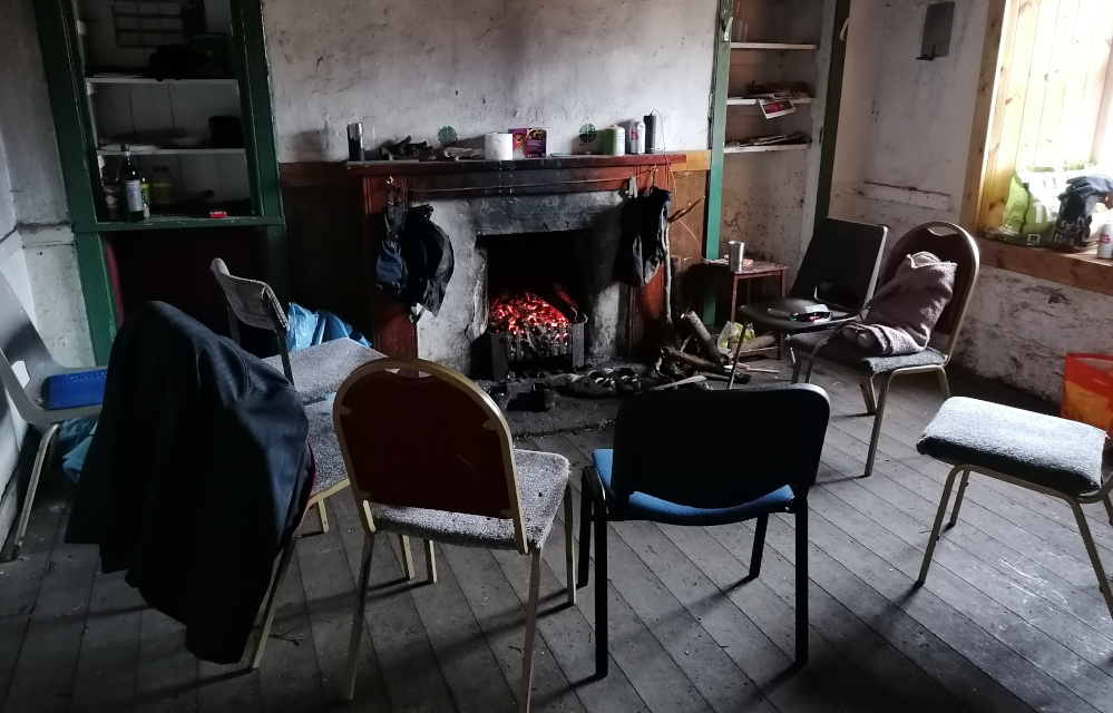
From my own experiences of bothies (I stayed in many both in England, Wales and Scotland, on multiple occasions) most people who use them are loners who enjoy extremities of solitude. Groups also use them, from men wanting to have a lad's night, to medics wishing to get away from the sterile environment of hospitals. Bothy users can and often do appreciate being out and about in the wildness for a variety of different reasons. Some are drug users using the remoteness of bothies to party illegally, others arrive with noisy motocross vehicles. For example: some people enjoy dominating and subordinating nature, whilst others are humbled and take sanctuary from being in awe of it.
Examine your own predicament and expectations, rationalize your approach when walking into an occupied bothy, observe reception and align demeanour accordingly.
Bothy users are normally sharing, although they can be condescending, especially if you have arrived ill equip. Most bothy users, both male and female, from my own experience have been respectful of gender. Nobody, unless it is a dire emergency (freezing to death) should be resting beside you on a platform, when floor space is available, first come, first served is a common rule acknowledged by most, if you arrived first and are settled in, they should move around you when settling in to accommodating themselves. Self-centred groups of bothy users arriving to party will view your want of solitude as a hindrance, sit fast in your space, you have every right to be there.

Bothies are typically dedicated to their previous inhabitants, some information maybe displayed about this. There are no religious or ethnic stipulations on the use of bothies; historically, tired and weary souls have been the most welcomed.
Be mindful about previous activity both inside and surrounding the bothy. For example bothy users going to the toilet, most will go out with a spade, and usually not far from the building to dig and bury their excrement. Do not draw water from this area, flowing or not, always use the rule of leaving the vicinity to draw water from upstream, not just for drinking but also to wash cooking utensils etc; you don't want to be coming in contact with Hepatitis A/B and C isn't it? Not to mention Ecoli, and all the other aliment's sewage carries. I've arrived in bothies to find plastic bottles of pysh everywhere, and even excrement sprayed up the walls (Wainhope Bothy, Kielder).
Burning fence posts is a common complaint against bothy users, I've never heard of a complaint of poaching, but that does not mean this does not happen! At Callater Stable bothy there was no wood burner, being so close to Braemar creeping mist from the loch pierced coldness into bone.
The majority of bothies are maintained by the Mountain Bothy Association, they make regular visits to these bothies to renovate and check on the upkeep, ensuring there is a standard of quality to the bare minium comfort a bothy provides. Police visit bothies looking for escaped criminals or missing people, bothies usually have an allocated police officer who will deal with any problems of legality that may very rarely be incurred from staying inside a bothy. Estate mangers will typically leave the bothies alone, unless they suspect you being detrimental to the estate, or if there is estate activities involving conservation of wildlife happening.
A local police office stationed around and about the Galloway forest once told me he'd been called out to a rave party consisting of more than two thousand revellers! I once arrived at Tunskeen Bothy to find an off duty paramedic tripped off his head on LSD.
You should always have an alternative in mind when planning to stay at a bothy, most bothies have surrounding areas where you can safely pitch a tent for the night. People come and go from bothies all the time, if you cannot access a bothy one night, the next you might be able to, also sometimes there is another bothy within walking distance. I think everybody feels vulnerable when staying at a bothy, but if you feel unsafe, leaving the bothy is almost always the best option, especially if the social situation continues to deteriorate without any sense of amicable resolve. Some bothies suffer from fuel scarcity, I recommend bringing charcoal, rather than coal, as it is much lighter to carry!
Whilst our ancestors were most definitely racist, in every sense, there are malevolent spirits trapped inside bothies. At Horton Green I was visited by a malevolent spirit of a wife beater, who disliked my presence enough to rattle whatever he could, against the calmness of the weather during the night. Other bothies can be sweetness and light, such as an old school converted into a bothy near Loch Loyal, up near Tongue, Sutherland.
The extent of isolation, the remoteness of bothies, can play tricks upon the mind. I've heard of a woman being so detached by the angst of society that she starved to death inside a bothy, fringe mentalities, disaffected by life, do exist in and about these places. I myself have experienced delusion from such isolation as the brain makes stuff up to compensate from lack of stimulation, insanity dwells upon the wild fringes of civilization.
Psychotic, "look twice, three times" episodes have been a significant occurrence whilst isolated to extremity. Innocent movements of nature can often cause disturbance, especially if you are hypervigilance about your safety, both inside and outside the bothy. Take comfort foods with you, and light a candle rather than an electric lamp / torch, remember to both nurture and rekindle your soul.
Although bothies can be squalid and idiot ridden, and at the best of times, cold, sparse and empty, they provided me with basic shelter far away from anti-White abuses I endured for almost over a decade. The far reaches were mostly influence free whenever bothy users came.
Once they place you upon the altar of multiculturalism they'll endeavour to see you sacrificed worthless, estranged from every worth your ancestors struggled for you to inherit, you'll be demonized, alienated and dispossessed from every sanctity you've ever known. It is imperative that you attempt reconnection with your ancestral spirit through extremity endured by them, raised into successive generations, reached out, at length unto us.
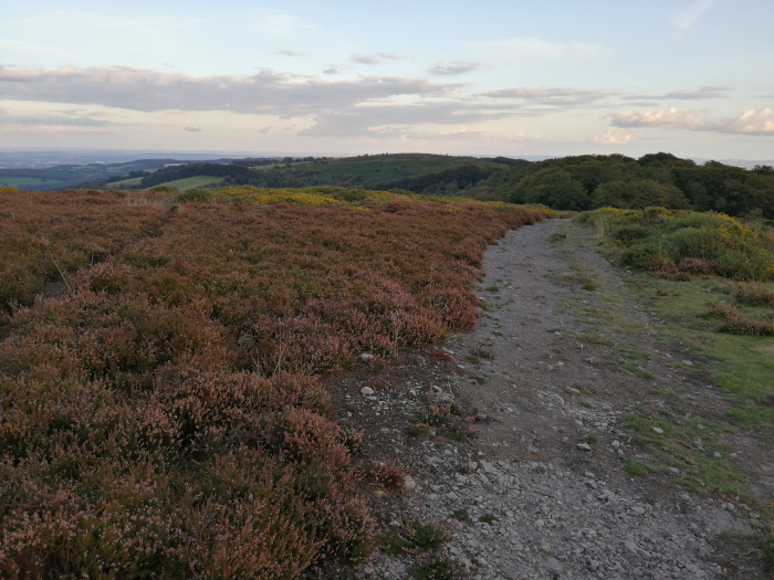
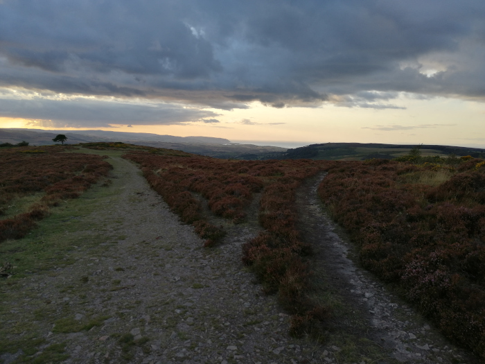
Wild Camping
Legality
Camping on open land, regardless of ownership, is legal in a few countries, including Sweden and Scotland. In Sweden, a right of public access – allowing outdoor recreational activity on privately held wilderness – is enshrined in the constitution. In Scotland, people may camp on most unenclosed land, whether state- or privately owned. There is however a 'leave-no-trace' policy and a common-law outdoor-access code.
Safety
The British country is safe, there are no dangerous animals, whilst venomous spiders and one species of snake will make you ill, they are generally not life-threatening, however, other people, as innocent as they appear have the potential to kill you.
The most important aspect of wild camping is for people not to know you are or have been wild camping. This mostly for safety, if psychopaths know you've been there once, they be waiting to ill fate you upon your return. You could also be preyed upon by predators, who could want just to spook your night, or worse rob, rape or murder you. So it is imperative that we leave locations as how we found them, not just for our personal safety, but for the sake of the environment.
Do not pitch near places frequented by people, or within locations known for wild camping, if you notice a previous "dirty" wild camp be mindful this could expose you to danger, you could be blamed for it.
Never tell anybody you are wild camping other than those close to you who should know about your safety. When you're isolated and alone, it's easy to over talk, maybe be overly friendly, especially in sociable places such as pubs, etc, where they maybe predators that will exploit your situation (hot shower, washing clothes, bed etc), if they offer after a few drinks the danger will rise tenfold, but your awareness will be diminished. Publicans have status, but as with taxi drivers they are informants, be mindful sharing information with them.
Remember when you are asleep you could not be more vulnerable, by placing yourself alone, out in the open you are trusting your surroundings, so make them safe by preserving privacy. If you are keeping an online blog about your travels, life, always publish entries 3-7 days after the events you're writing about. Be mindful about being predictable, for example if you are walking the Ridgeway, you'll want to publish the journey all at once to avoid predators being able to predict where you are going to be.
Don't buddy up with other people, ramblers, walkers, etc, especially if they initially approach you from a different direction to where you are heading. Stalkers don't just follow from behind, they also follow from being in front. They may be wanting to walk with you for an opportunity to steal your kit, or worst abuse you, people have assorts of reasons for being alone. Be not too worried about seeing car headlights, although you might feel exposed the driver will be focusing on what's ahead within the road, rather than searching into the distance for something or somebody they won't know is there, chances are they would not be interested in you anyway.
Stealth
You must likely be thinking about pitching every evening at dusk. During these hours, shadow and silhouette are more evident, and through the night under a visible full moon. Peoples perceptions are heightened during the night, most people could be shocked by becoming aware of your presence, their mind is likely to race, imagining assorts of possibilities, chances are they could be more frightened than you, as through experience you'll probably know the outdoor environment better than them.
If you are pitching a tent in a woodland, come at least fifty yards away from the footpath. Think perimeter, using brambles, bracken, hawthorn trees to protect you, it is always best to find a protected area than to create one. Don't be spooked out by noises, you are taking sanctity in nature, living with, as with nature, if you are harmonizing with your environment animals that are not a threat will accept your presence as relevant. Don't be frightened of undergrowth, but always be mindfully aware of wherever you step.
I really enjoy a good open fire, when I am cold and tired I find the heat replenishing, but I recommend not lighting an open fire unless survival depends on it. Most of the time a fire such as this will act as a beacon, people will know where you are for miles around unless you are covered by dense woodland, I'd avoid it. Even if you are elevated above sight, people can still make out a glow, remembering shadow and silhouette. If you do have an open fire, use dry wood, you don't want to be creating lots of smoke.
Be safe and remain unseen, think Shadow and Silhouette / Camoflarge and Concealment.
It is much better to dig a fire pit if the ground is not too hard, failing that clear fallen leaves back, disperse ash (cold) and recover the area before you go. If the water table is height, place rocks in the groundwater and light your fire on top of that. Only burn wood that you plan to use, burn't wood will reveal that you have been there; this is not an absolute priority, but something to bear in mind. Burn all used toilet roll rather than bury it, leave no rubbish behind and brush or slide tracks when leaving the location.
If you are found nine times out of ten, you'll be rung into the police. If officers come be responsive and civil, don't try to hide or pause for time in your tent, unzip your tent wide. Let them know how long you are staying in the area, most likely 1-2 days, and you intend to pitch down and move your presence at dawn; they will not usually ask you to move if it is already dark, and you are reasonably safe. It is always best not to talk too much, just tell them what they need to know, keep answers vague about where you have been / where you are going, authorities have the worst capability for committing most horrendous abuses, because they are shielded with positions of trust.
If you are found, evaluate your situation, it's much better to speak with who find you, if approached it is best to assess them as a potential threat but not advisable to follow or approach them as strangers; stay on the side of minding your own business. If you believe yourself to be at risk, it is much better to pack up and pitch somewhere else rather than readying defence for a possible attack; get a good sleep at a different locality rather than no sleep where you are; once you are triggered, hypervigilance will elaborate the smallest disturbance as an unsubstantiated provocation.
Shelters
Bivouac
Bivouac (French deriving from an 18th-century Swiss German usage of Beiwacht, bei by, Wacht watch or patrol) refers to a shelter constructed of natural materials like a structure of branches to form a frame, which is then covered with leaves, ferns, and similar material for waterproofing and duff (leaf litter) for insulation.
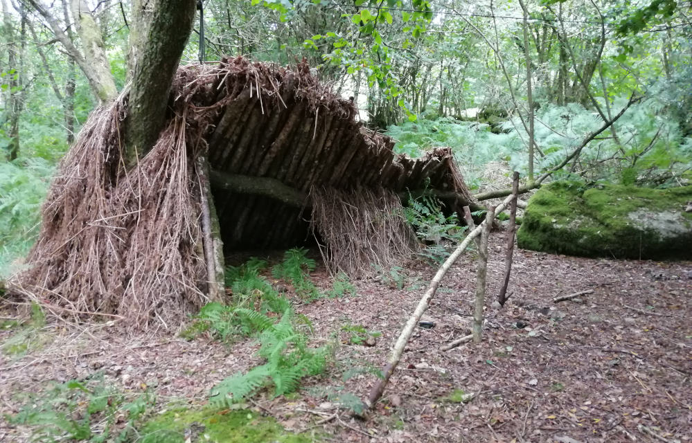
Single-sided designs allow easy access and allow the heat of a fire into the shelters, while full roofed designs have much better heat retention. As a general rule, the roof should be at least a foot thick and opaque to block sunlight. These shelters, simple as they are, take time to erect, so used if you plan to stay a few days.
A bivouac sack is a smaller type of bivouac shelter. Generally it is a portable, lightweight, waterproof shelter, and an alternative to larger bivouac shelters. The main benefit of a bivouac sack shelter is speed of setup and ability to use in a tiny space, as compared to tent-like shelters. A bivouac sack is therefore a common choice for those camping in tight areas.
Long Distance Footpaths
If like me, you have suffered endlessly walking around urban areas due to anxiety why not take it to the countryside, and see, venture into beautiful places, embrace a healing ascetic that has for thousands of years been revered by our ancient ancestors.
National Trails in:
| Name | Length | Region | End Point One | End Point Two | Description |
|---|---|---|---|---|---|
| Cleveland Way | 110 mile / 177km | North Yorkshire, England | Helmsley | Filey Brigg | Runs around the edge of the North York Moors National Park in a horseshoe configuration. |
| Cotswold Way | 102 mile / 164km | The Cotswolds, Central England | Chipping Campden, Gloucestershire | Bath, Somerset | Runs along the Cotswold Edge escarpment of the Cotswold Hills. |
| England Coast Path | 2,795 mile / 4,500km | England | Will cover the entire coast of England and will be the longest managed and waymarked coastal path in the world. | ||
| Glyndŵr's Way | 135 mile /217km | Powys, mid Wales | Knighton | Welshpool | Runs in an extended loop. |
| Hadrian's Wall Path | 84 mile / 135km | England: Tyne and Wear, Northumberland, Cumbria | Wallsend, Tyne and Wear | Bowness-on-Solway, Cumbria | Runs from the east to west coast along the remains of Hadrian's Wall. |
| North Downs Way | 153 mile / 246km | South Eastern England | Farnham, Surrey | Dover, Kent | Passes through the areas of outstanding natural beauty (AONB) of the Surrey Hills and Kent Downs. |
| Offa's Dyke Path | 177 mile / 285km | Wales–England border | Sedbury, Gloucestershire | Prestatyn, Denbighshire | Follows close to the border near the remnants of Offa's Dyke. |
| Peddars Way and Norfolk Coast Path | 97 mile / 156km | England in Suffolk and Norfolk | Knettishall Heath, Knettishall, Suffolk | Cromer, Norfolk | The two paths join at Holme-next-the-Sea. |
| Pembrokeshire Coast Path | 186 mile / 299km | Pembrokeshire, southwest Wales | Poppit Sands, near St Dogmaels | Amroth | Has a total of 35,000 feet (11,000 m) of ascent and descent and lies almost completely within the Pembrokeshire Coast National Park. |
| Pennine Bridleway | 205 mile /330km | Pennines, Northern England | Middleton-by-Wirksworth, Derbyshire | Ravenstonedale, Cumbria | Runs roughly parallel to the Pennine Way. |
| Pennine Way | 267 miles / 430km | Pennines, Northern England and Southern Scotland | Edale, Derbyshire | Kirk Yetholm, Scottish Borders | Spans the length of the Pennines, according to the Ramblers, "one of Britain's best known and toughest" trails. |
| The Ridgeway | 87 mile /140km | Berkshire Downs, Southern England | Overton Hill, near Avebury, Wiltshire | Ivinghoe Beacon, Buckinghamshire | Ancient trackway on a chalk ridge described as Britain's oldest road. |
| South Downs Way | 100 mile / 161km | South Downs in Southern England | Winchester, Hampshire | Eastbourne, East Sussex | Within the South Downs National Park. |
| South West Coast Path | 630 mile / 1,014km | England: Somerset, Devon, Cornwall & Dorset | Minehead, Somerset | Poole Harbour, Dorset | Originated as a route for the Coastguard to walk from lighthouse to lighthouse patrolling for smugglers. |
| Thames Path | 184 mile / 296km | Southern England | Kemble, Gloucestershire | Thames Barrier, Charlton | Follows the River Thames from its source to the Thames Barrier in London. |
| Yorkshire Wolds Way | 79 mile / 127km | Yorkshire, England | Hessle, East Riding of Yorkshire | Filey, North Yorkshire | Runs around the Yorkshire Wolds. |
| Name | Length | Region | End Point One | End Point Two | Description |
|---|---|---|---|---|---|
| Annandale Way | 55 mile / 89km | Solway Coast, Dumfries and Galloway | Moffat | Annan | Follows the valley of the River Annan from its source in the Moffat Hills to the sea in the Solway Firth. |
| Arran Coastal Way | 66 mile / 107km | Isle of Arran | Circular route around the coastline of the Isle of Arran. | ||
| Ayrshire Coastal Path | 100 mile / 161km | Ayrshire | Glenapp, Ballantrae | Skelmorlie, North Ayrshire | Runs alongside the coast and forms part of the International Appalachian Trail. |
| Berwickshire Coastal Path | 28 mile / 45km | Scottish Borders and Northern England | Cockburnspath, Scottish Borders | Berwick-upon-Tweed, Northumberland | Coastal path spanning the Anglo-Scottish border. |
| Borders Abbeys Way | 68 mile / 109km | Scottish Borders | Circular route in the Borders passing through the ruins of many abbeys: Kelso – Jedburgh – Hawick – Selkirk – Melrose. | ||
| Cateran Trail | 64 mile / 103km | Perth and Kinross and Angus | Blairgowrie and Rattray | Circular route covering many conditions such as farmland, mountains and forest: Blairgowrie – Kirkmichael – Spittal of Glenshee – Alyth. | |
| Clyde Walkway | 40 miles / 64km | South Lanarkshire | Glasgow | New Lanark | Runs close to the River Clyde for most of its length. |
| Cowal Way | 57 miles / 92km | Cowal Peninsula, Argyll and Bute | Portavadie | Inveruglas on Loch Lomond | Connects with the West Highland Way. |
| Cross Borders Drove Road | 52 miles / 84km | Edinburgh and the Scottish Borders | Little Vantage | Hawick | One of the newest trails based on existing routes. |
| Dava Way | 24 miles / 39km | Moray | Grantown-on-Spey | Forres | Follows the route of the former Highland Railway which closed in 1965. |
| Fife Coastal Path | 117 miles / 188km | Fife | Kincardine | Newburgh | When opened it originally ran from North Queensferry to Tayport, but was later extended. |
| Formartine and Buchan Way | 53 miles / 85km | Aberdeenshire | Dyce, near Aberdeen | Fraserburgh and Peterhead | Follows the track of the former railway line the Formartine and Buchan Railway which closed in 1970. |
I have so far (at the time of writing this) walked Offa's Dyke Path, North and South Downs Way, Cotswold Way, Pennine Way and The Ridgeway as well as various sections of England's Coastal Path including, Devon, Cornwall, Yorkshire, Dorset, Norfolk and Pembrokeshire. I have probably walked upon sections of most long distance paths, such as the Southern Uplands Way, but rarely completely these paths from start to finish, for example I completed the Ridgeway footpath in three segments.
“When I became displaced on the streets of London, trauma induced anxieties prevailed, endlessly walking me through every depravity in every district within the city. Until one day I though why do this? Why not use this kinetic energy to see and explore beautiful places; reconnect with the spirit of ancestors that dwells about the awe-inspiring aesthetic of our homeland.”.
There are collections of hills and successions of mountains to climb, such as the legendary Caer Idris, Snowdonia in Wales. The absolutely beautiful Cheviots along Scotland's borders, and in England the Malvern hills, the Black Mountains and the Lake and Peak Districts as well as Dartmoor and the Yorkshire dales. Our homeland is truly beautiful, in every defined natural aspect, from the round rolling feminine hillsides, to the craggy edge of the masculine mountain edge, here, this, the land is us. Sole of foot to soul of people; steadfast.
“Have no time nor day for those not even will to walk part of the way, never to stay means never to be, to see as we have always been seen, to see, endless projection returned unto the bold, brave face of thee.”.
From these adventures of utter loneliness, I came to believe in myself, as the land, in the formation of who I am. It is those who refuse to walk, live and exist with us, to walk, in part along our life journey who sacrifice themselves, not us, because our land knows every one of us, through legacy, succession after succession, placed and displaced, we've always been here, generation after generation of our regeneration.
Mountains
Between 2016 and 2020 I climbed many mountains both in England, Wales and in Scotland. A sense of accomplishment is essential to well-being, especially when facing all-out disinheritance; because you just need to remind yourself that your inherent worth is always with you through honouring your ancestors that bestowed that worth to pass on to your people, through nurturing succession. Because this is stolen from us, we can turn to natures embrace within ascetic of our ancestral homeland.
Never lie down and die, especially if you are being cast out as an opportunity mule, by haters who believe you should be fleeced hapless until you are disinherited worthless, deprived of every sanctity but refuse to scratch at nothing to plead for anything.
Hills
It's not always about how high you can climb up a mountain, hill sides can be nurturing, the subtle curvature of a long slope can be nurturing, there is a time for gentleness in life and for me, hillside walking has that. The Malvern Hills (Grid ref Lat/ Long: 52.1226°N 2.3432°W) are made from some of the oldest rock in England (around 680 million years old) and extend some 8 miles (13 km) through two West Midlands counties Worcestershire and Herefordshire as well as northern Gloucestershire in the southwest. The highest point of the hills is the Worcestershire Beacon at 425 m (1,394 ft) above sea level.
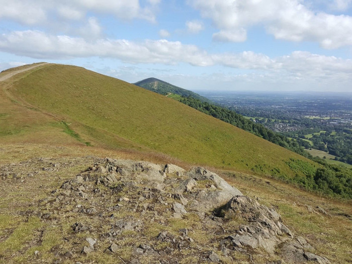
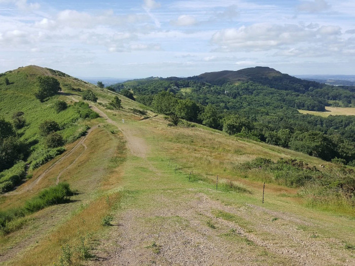
The Malverns hold significance for me as I walked these hills with my father as a child. More recently, at least forty years later I arrived at the Malverns and commenced my ramble north from Midsummer hill on the dawn of Summer Solistice 2019. At the summit of Midsummer hill there is a public shetler that gives some basic shelter from the rain, and there is also a cave located a mile or two to the north. I was stalked relentlessly, disturbing me, I cannot explain what it is like to have such sanctities raped, and it was the memory of my deceased father (died of brain cancer in 2013) they disturbed the most. But the panoramic view of the sunrise rising from the East was awesome expanse.
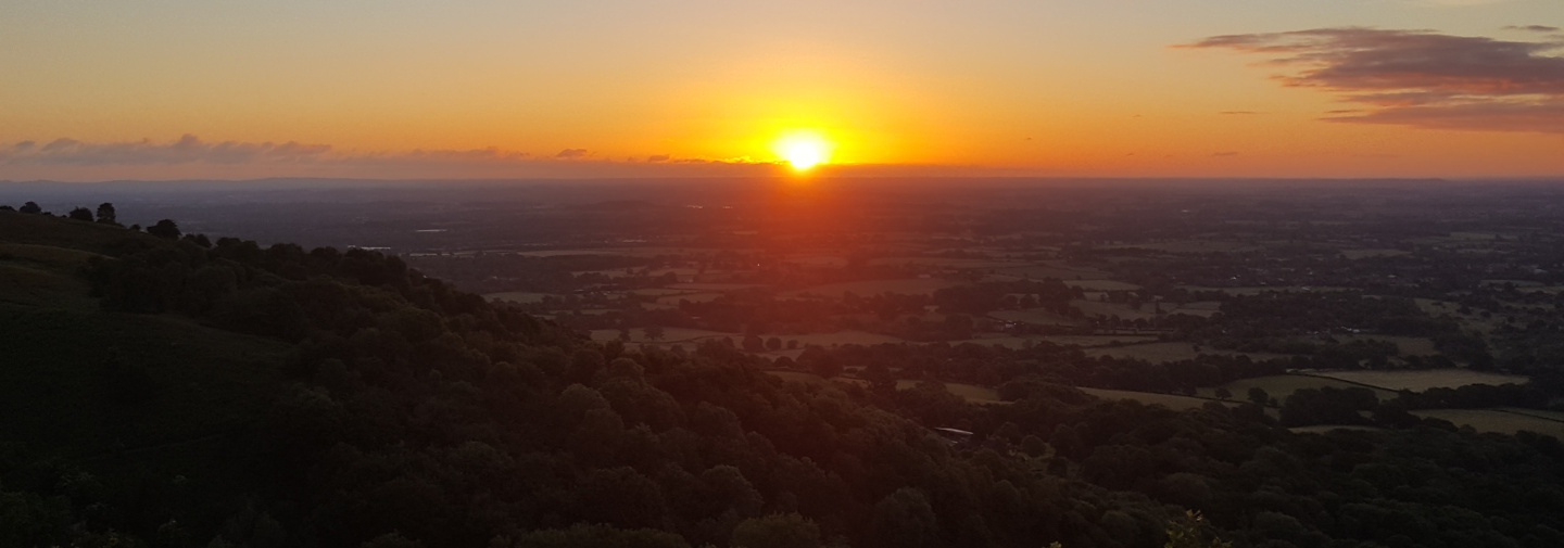
North of Hadrian's Wall and the Tyne Valley, the land rises to form the Cheviot Hills (Grid ref Lat/ Long: 55.478°N 2.152°W), which extend into Scotland and could probably be considered part of either the Southern Uplands or the northern Pennines. They are included in Northumberland National Park, along with Kielder Water and the Kielder Forest. These hills are beautiful with aesthetic that touches my heart in some many ways, I have few photos surviving, and the ones that exist don't really do the hillside justice.
The Quantock Hills (Grid ref Lat/ Long: 51°08′39″N 3°13′59″W) west of Bridgwater in Somerset, England, consist of heathland, oak woodlands, ancient parklands and agricultural land. They were England's first Area of Outstanding Natural Beauty, designated in 1956. The Quantock Hills west of Bridgwater in Somerset, England, consist of heathland, oak woodlands, ancient parklands and agricultural land. They were England's first Area of Outstanding Natural Beauty, designated in 1956. The hills run from the Vale of Taunton Deane in the south, for about 15 miles (24 km) to the north-west, ending at Kilve and West Quantoxhead on the coast of the Bristol Channel.
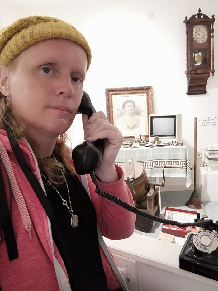
Museums
These places are heavily scrutinized by socialism because they are places with much to do of our ancestors, so although risky, are beneficial places to visit, but know you are being observed. This is one of the places disinheriting cranks will decimate you to prevent you from rekindling your ancestral spirit.
Dial 911: “Hell O, yesUHA, every freedom our ancestors strived and died for was betrayed”. Rhayader, Wales 2017
Most people believe curators are there to watch over exhibits, but this is true only in part. They also oversee how you react to exhibits or artefacts, to witness if you make any connection with them. You could be cursed by a visit which could have tribulations launched against you, bearing in mind I have never known a visit materialize any good fortune.
The least risky museums are those same ones located to a town or village, national park you may visit. Museums to avoid are the Tate Britain, National Portrait Gallery and the British Museum (where Karl Marx written his manifesto, compiled from the wrongful goings-on in the workhouses, and the artificial scarcity that created them.).